There are a number of peculiarities you can acquire from growing up in the South Wales Valleys. One (from a time when most people travelled by car, bus or train) is that you think people in the next door Valley live a million miles away.
Mostly because a visit next door required a drive up or down the Valley to a ‘crossing’ point.
In reality, if I’d bothered to walk like my ancestors, I’d realise everything is actually very close by.
Aberdare and Maerdy are physically quite close together, and both not that far from Merthyr.
I’d imagine it might blow the mind of your average Maerdy dweller realising they could walk to the busy metropolis of Merthyr in a morning.
Anyway, enough of winding up Maerdy people. Here’s a few pictures of a glorious Easter Ramble from Dare Valley Country Park to the site of Maerdy Colliery and back.
Mostly for the purposes of not forgetting a few things I’d like to go back to.
Dare Valley Country Park. Yes, that’s Pen y Fan in the distance.
In the foreground is the site of the Bwllfa Dare Colliery and Brickworks.
The whole area was heavily industrialised for over 150 years until it became a country park in the 1970s.
Well done Cynon Valley District Council. Proper future generations thinking.
The most southerly glacial corrie in the UK.
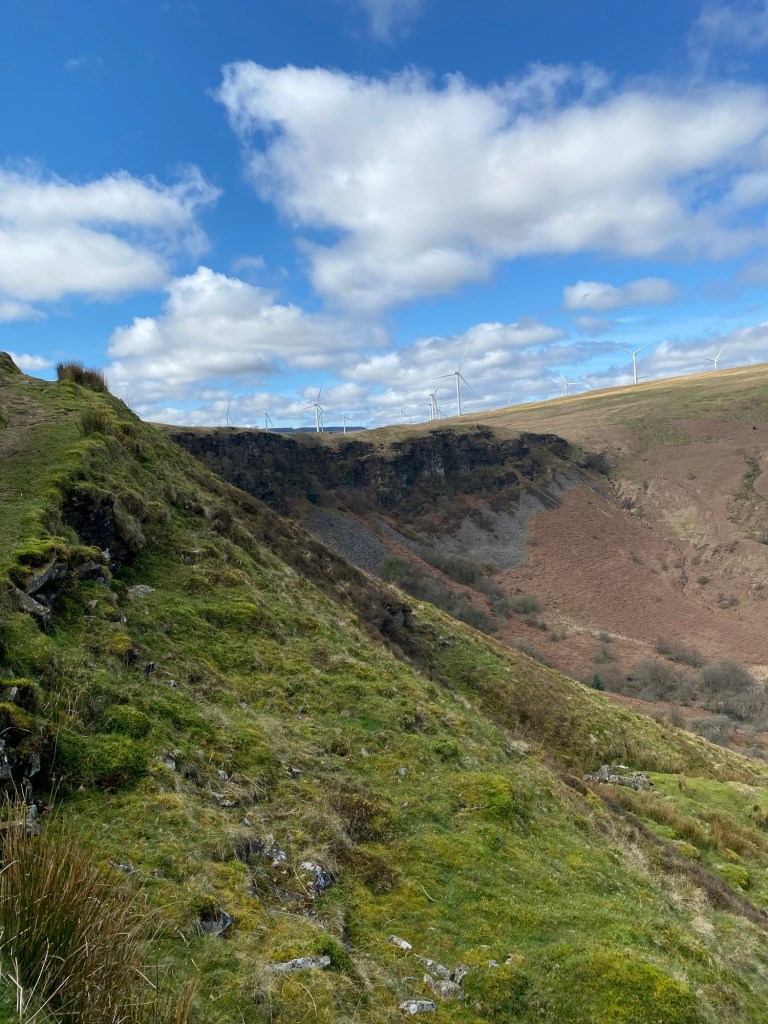
The last ice age in the UK literally ended at Aberdare. I’ll leave that one with you.
The crags know as the Darren is where the Afon Dar rises and the home of Peregrine Falcons.
A convenient ‘food shop’ distance down to the Pigeon Lofts on Bwllfa Terrace (if you are a Peregrine Falcon).

The Great Glamorgan Way isn’t actually a single ‘way’. It’s about 14 different bridleways and cycle paths that cover the area from the coast at Ogmore up to the Heads of the Valleys. This sign was on the Pentre to Maerdy stretch.

On the topic of routes I know nothing about. Here’s one for the Lost Peatlands Project. With a lovely QR code, which was slightly ironic as there was absolutely no phone signal at that point to look up the QR code.
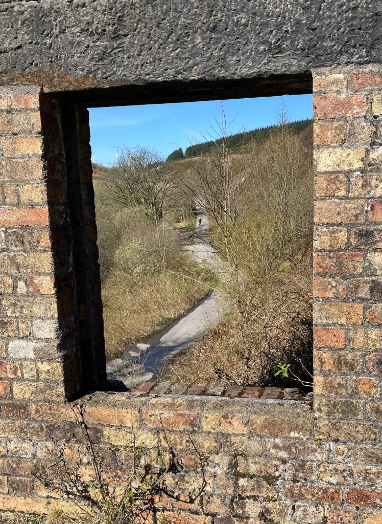
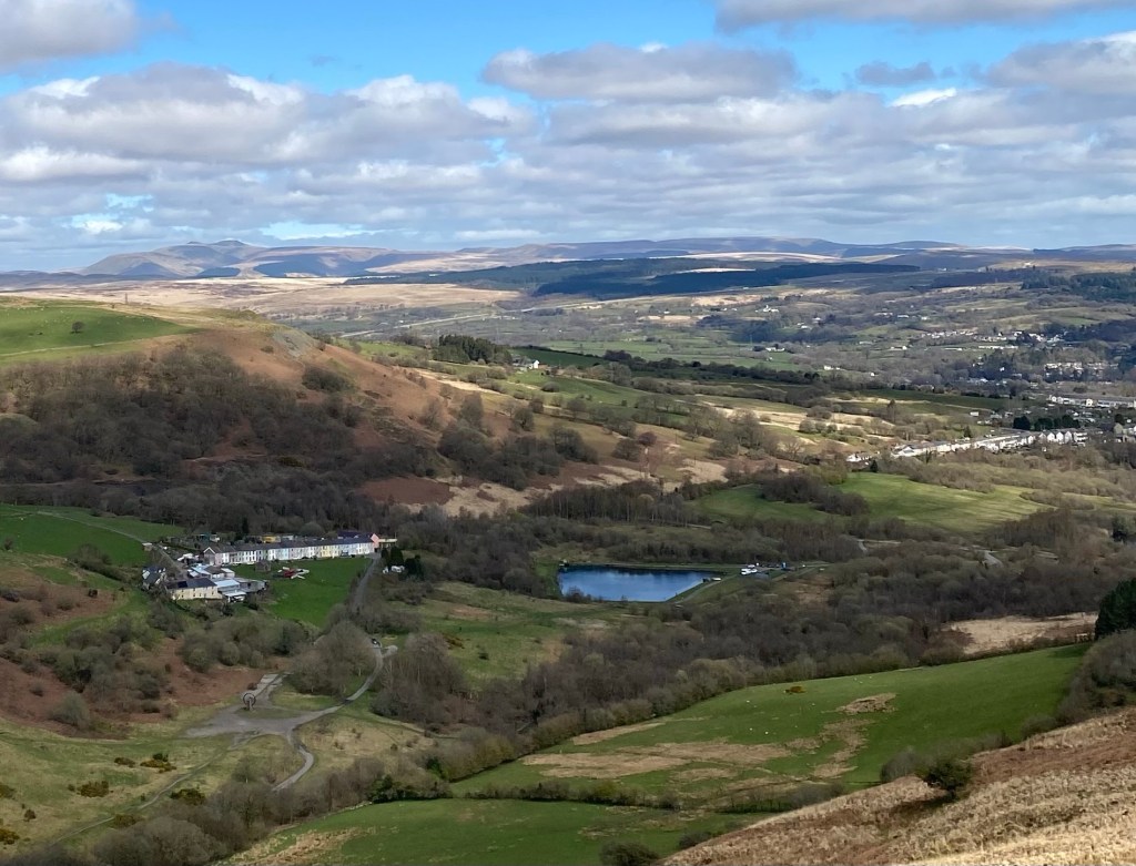
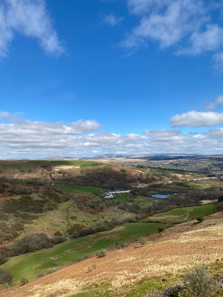
View from the abandoned Pontypridd Water Company pump house up towards the reservoir.
A poignant reminder of why investment in clean drinking water is a basic requirement of society.
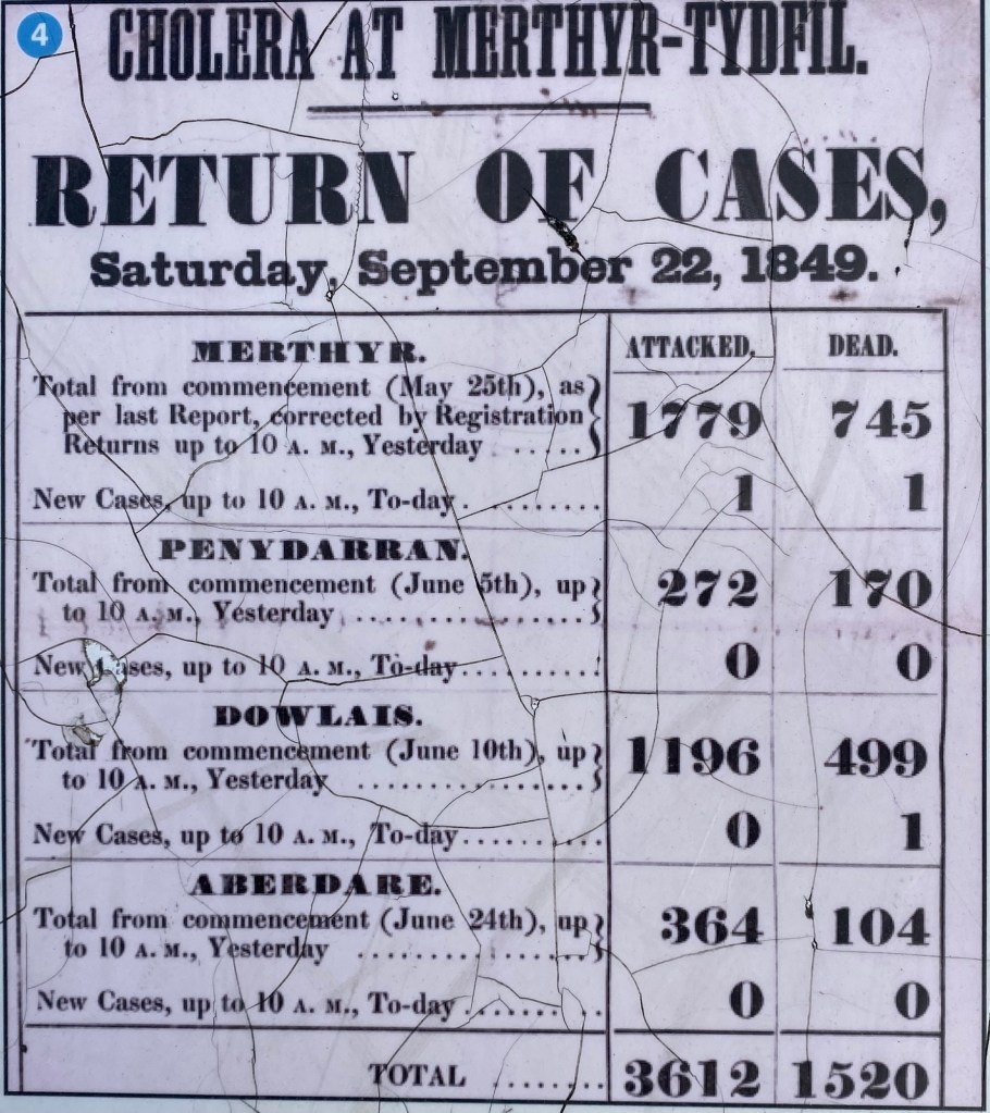
This sign is part of a display in Aberdare town centre. I didn’t think we’d be walking so close to the infrastructure that was critical in the fight against cholera.
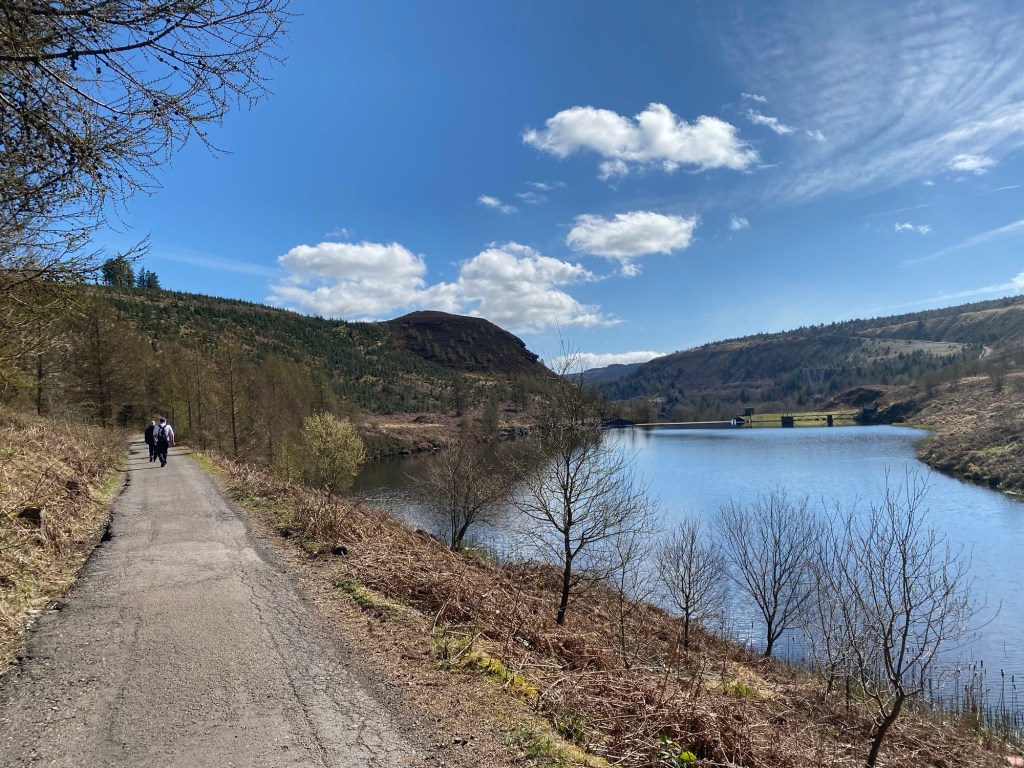
Castel Nos Reservior. A beautiful asset in a beautiful location, delivering the basics of public health. Literally saving lives for over a 100 years.
I did say this post was to remind me about going back to some things.
Just to finish things off on here’s another gorgeous view.
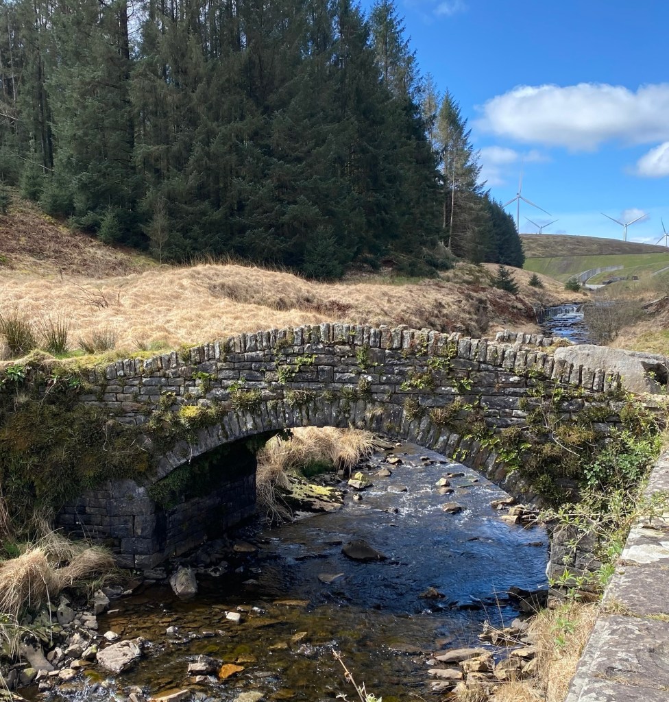
Pont Lluest-wen Bridge.
Possibly the highest bridge on the Rhondda Fawr River.
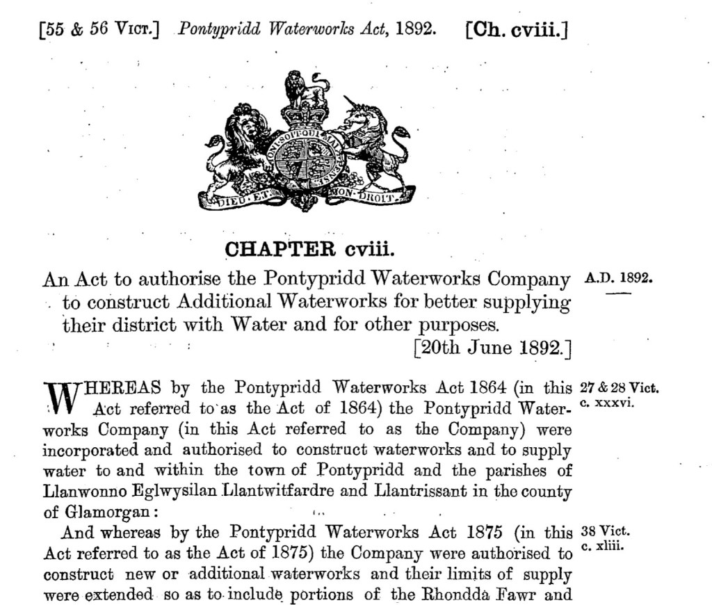
It looks new(ish) and in incredibly good condition considering it gets a mention in the 1892 Pontypridd Waterworks Act of Parliament.
Like I said, there’s a lot I would like to go back to here.
Footnote. I’d forgotten that I wrote this about another drinking water reservoir supplying the South Wales Valleys. The Grwyne Fawr Reservoir built by the Abertillery District Water Board 1912-1928.

Leave a comment